LPL Fieldtrip Spring 2013 – Mojave Desert Remote Sensing
Whether by telescope or spacecraft, when we look at the surfaces of other planets we do so through remote sensing instruments. There is a wide variety of such instruments from Synthetic Aperture Radars to visible wavelength cameras and an even wider range of geologic features to examine from sand dunes to lava flows. On Earth, remote sensing is further complicated by vegetation and features constructed by humans. However, there is one great advantage to remote sensing data analysis on the Earth – you can actually visit the site to test your conclusions…
On this trip we packed our bags for the Mojave Desert, but not before doing some analysis of remotely sensed data from a variety of instruments on both aircraft and spacecraft. In this way we aim to test our ability (or the data’s ability) to determine something of the surface properties in advance. The Mojave is a great area for such an experiment both because it has a wide variety of geology and because it is well covered by many different datasets.
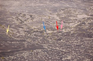
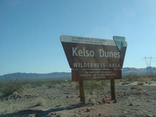
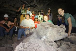
After a lengthy drive, our first stop was the Kelso dunes. Armed with a shovel (the shovel actually saw a lot of use on this trip), we set out to explain the appearance of the dunes in Synthetic Aperture Radar (SAR) datasets. These data show the dunes are dark in the shorter wavelength bands (such as the 5cm C-band) and brighter in the longer wavelength bands (such as the 25cm L-band and 80cm P-band). Some digging revealed a possible cause – the upper sand is dry quartz grains (with a low dielectric constant that doesn’t scatter radar waves well); however, about 20-30 centimeters (8-12 inches) below the surface a wet layer was found. The longer wavelength radar waves may be sensing this higher dielectric constant layer and scattering more. It was late in the day, but after racking their brains about what to do next some people managed a moonlit hike to the top of the dunes.
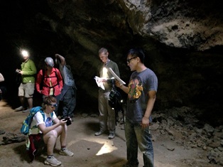
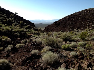
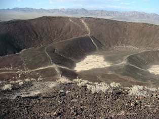
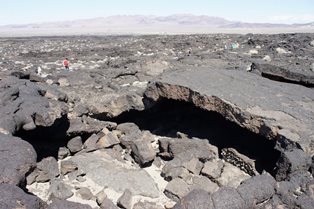
Kelbaker Road runs through the Mojave and is full of interesting sites. Just a few miles from Kelso, we stopped at a rock outcrop that we had identified as ‘interesting’ in some hyperspectral imaging data. Two spectrally distinct rocks were visible here that turned out to be a limestone and a shale. They in turn were quite distinct from the surrounding alluvium, which turned out to be dominated by coarse quartz grains. We pressed onward to Old Government Road, which led us down to Soda Lake (a playa). SAR data show the playa surface to behave very differently in C, L and P bands and to have large variations from place to place. Some more digging revealed that many of these differences were probably due to the depth where the playa sediment transitions from dry to wet. Additionally, roughness differences between parts of the playa dominated by silt and parts dominated by evaporate deposits contributed to the differing radar brightnesses seen in the data. The Cima volcanic field was next door and we stopped here to look at roughness differences between volcanic flows of different ages and how they manifested themselves in the radar data. Many of the Cima cinder cones also show spectral differences between their summits and lower flanks in our hyperspectral datasets. Close inspection from hiking to the top and back (which proved to be more involved than expected) of one cone suggested weathering differences of the cinders led to the spectral differences. Finally at Cima we checked out a lava tube cave. Recent high-resolution planetary cameras have resulted in the discovery of several such caves on Mars and the Moon.
The next day we drove a loop around the Mojave stopping first at some agricultural fields. Some enigmatic radar-bright radial bands in these circular fields are probably due to concentric ridges at the L-band wavelength scale that result from the concentric planting of alfalfa grass. The strongly depolarized radar return here is probably due to the vegetation itself. Such pathological topography (not to mention the vegetation) is unexpected on other planetary surfaces. Our second stop of the day was the Pisgah lava flow and cone (or rather what’s left of it as it’s being mined away). We investigated obvious brightness and depolarization contacts in the radar data of the lava field that correlated with dramatic changes in surface roughness. We also had the chance to explore Glove cave, another lava tube, and hear about the astrobiological research that happened there and its relevance for other lava tubes around the solar system.
Our final stop for this day was the Amboy lava field and cinder cone. In visible-band orbital imagery the Amboy cone has a dark streak emanating from it to the southeast. Examination of C-band radar data suggests the streak also scatters more radar energy. Rick Greenberg joined the trip in his plane and flew to Amboy to help us characterize the streak from the air. On the ground the margins of the streak are very diffuse, but with the help of Rick and his passengers we were able to locate it. Unfortunately the weather and delays on the road meant we only had the time to map out its northern edge. The formation of the streak seems to be related to the rate of delivery of silt-size material. Within the streak, this rate seems slow enough that the dark rocks can rise to the surface forming a dark desert pavement with the brighter silt underneath. Outside the streak, continuing silt delivery seems fast enough to keep these dark rocks buried. The radar brightness difference may also be related to this. Basalt contains appreciable iron, which the silt does not. A desert pavement of basaltic pebbles is both rougher and has a higher dielectric constant than areas dominated by silt.
Rick and crew landed safely and camped with us in Amboy that night. The next morning we visited Broadwell lake (another playa), which (in contrast to Soda Lake) is homogeneously dark at all radar wavelengths. The surface here is smooth packed silt and bone dry as far down as we could dig. There’s nothing in the surface composition or roughness to scatter radar power in the backward direction towards the receiver.
A trip to the Mojave is always fun from a geological perspective. This time however we also gained a little remote sensing intuition. Other places in the solar system are less easy to visit, but hopefully we can make more sense of their surfaces now.
|
|
|
|
|
|
|
|
|
|
Photo courtesy James Keane. |
Photo courtesy James Keane. |