February 25 Lecture
Mars
link to basic Mars data:
http://nssdc.gsfc.nasa.gov/planetary/factsheet/marsfact.html
Overview
The 4th planet
from the sun at 1.52 AU
–The 3rd largest rocky (terrestrial)
planet in the solar system with an equatorial radius of 3402 km
(3000 km smaller than Earth)
–1/3rd Earth’s surface gravity
–Eccentric orbit (0.09 compared to
0.01 for Earth) is as important as the planet’s tilt in causing
seasons
–2 small captured asteroid ‘moons’
Phobos and Deimos
–Distinctive reddish color from
‘rusted’ iron compounds
–Geologically very active in the past
– home of the solar system’s largest volcano (Olympus Mons) and
largest canyon (Valles Marineris)
–Possesses surface water in polar ice
caps which may have flowed in ancient times
–The most clement body in the solar
system (after the Earth) for supporting life as we know it
Mars
through history
Visible to the naked eye
and known to early astronomers
–Red color earned it the title of
‘god of war’ for the Greeks (Ares) and Romans (Mars)
–Mars' red surface color actually
comes from a coating of oxidized iron-bearing rock and dust
particles (like rust).
Helped Kepler derive his
laws of planetary motion in 1609
–The large eccentricity could not be
reconciled with circular orbits
By the late 1800s
telescopes were powerful enough to observe surface features
–Giovanni Schiaparelli observed the
1877 martian oposition and Percival Lowell began his observations
in Flagstaff in 1893
–They claimed they saw evidence for
Martian life and civilization
The ‘Canals’ and ‘Oases’ of Mars
A large greenish bluish triangular
feature (Syrtis Major) thought to be plant life
–Not all astronomers could
distinguish or agree on what was being seen
The
"Canals":
A fanciful "canal scape":
from “The Decline and
Fall of the Martian Empire” by Kevin Zahnle (2001) in Nature
(http://www.nature.com/nature/journal/v412/n6843/full/412209a0.html
)
The great
English science fiction author H. G. Wells wrote the classic
"War of the Worlds" describing a Martian invasion,

and other authors such as Edgar Rice Burroughs and Ray
Bradbury described an inhabited Mars.
In reality
there are no canals and there is no vegetation -- these were just
optical illusions due to the difficulties of observing Mars
through the Earth's atmosphere.
View of Mars
from the Mariner 4 spacecraft flyby (1965). The first close-up
photographs of Mars were from spacecraft, and they indicated a
bleak, cratered, lunar-like landscape.
Hope of
ancient civilizations on Mars were dashed
View of Mars
from the Hubble Space Telescope, showing the north polar cap and
high clouds over the Tharsis volcanoes:
Before we had such data,
Mars remained largely a mystery until the robotic exploration of
the 1960s and 1970s.
Mars Exploration
Mars has been a hard target to
explore. Here is a scorecard:
http://www.bio.aps.anl.gov/~dgore/fun/PSL/marsscorecard.html
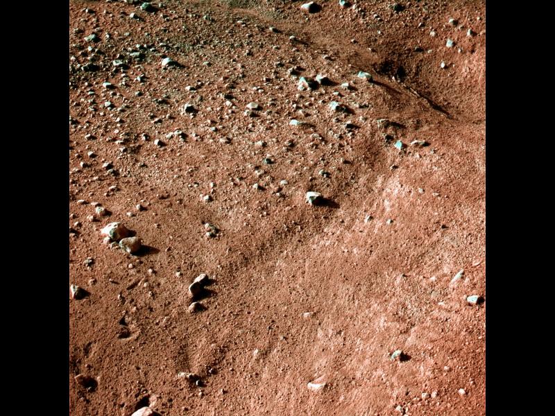
Some successful (and unsuccessful)
landing sites:
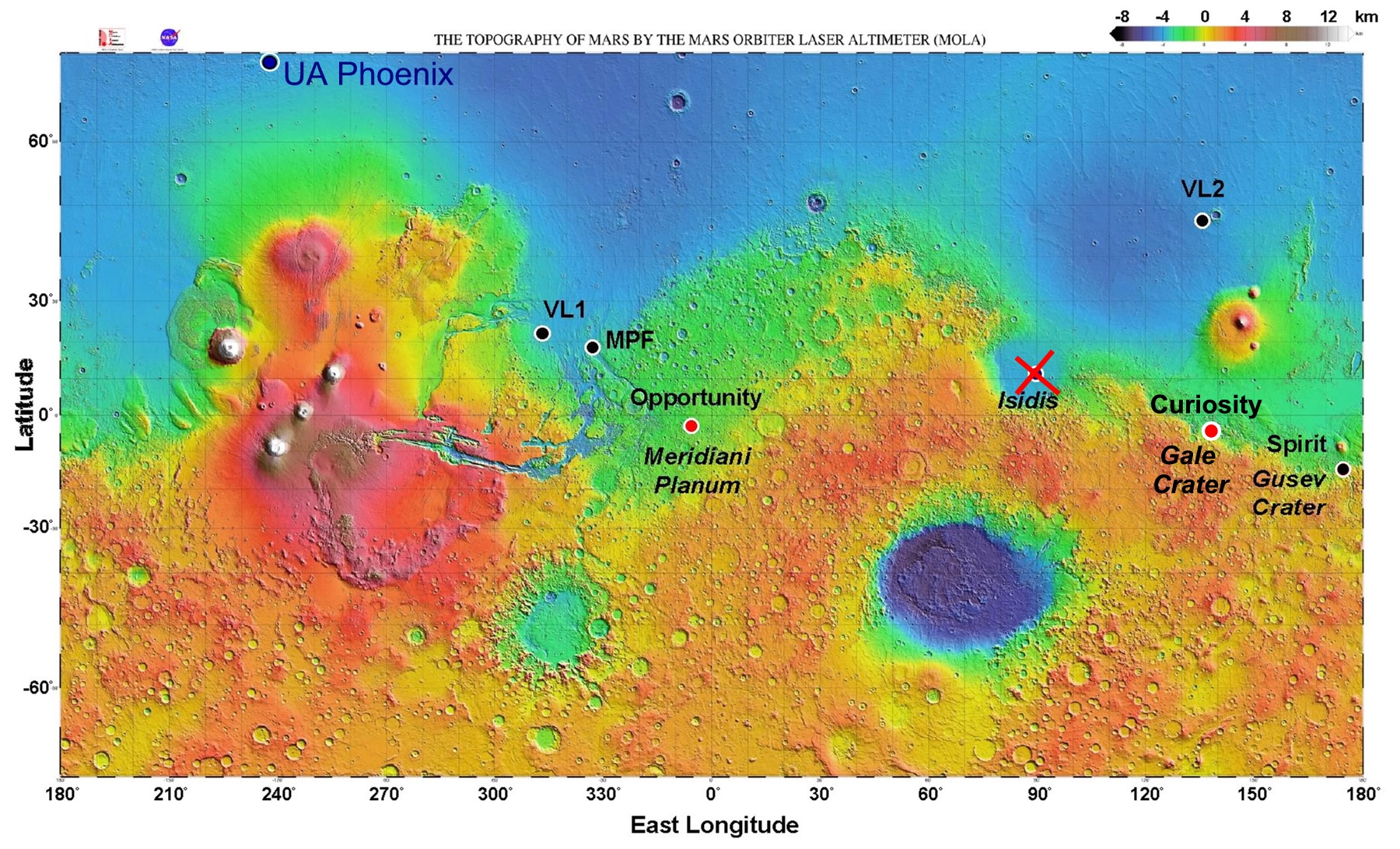
Mars'
greatest
similarity to Earth: polar caps and seasons
Mars has subsurface water at high latitudes and ice caps at both
poles. Like the Earth's ice caps, Mars' ice caps change
with the seasons:
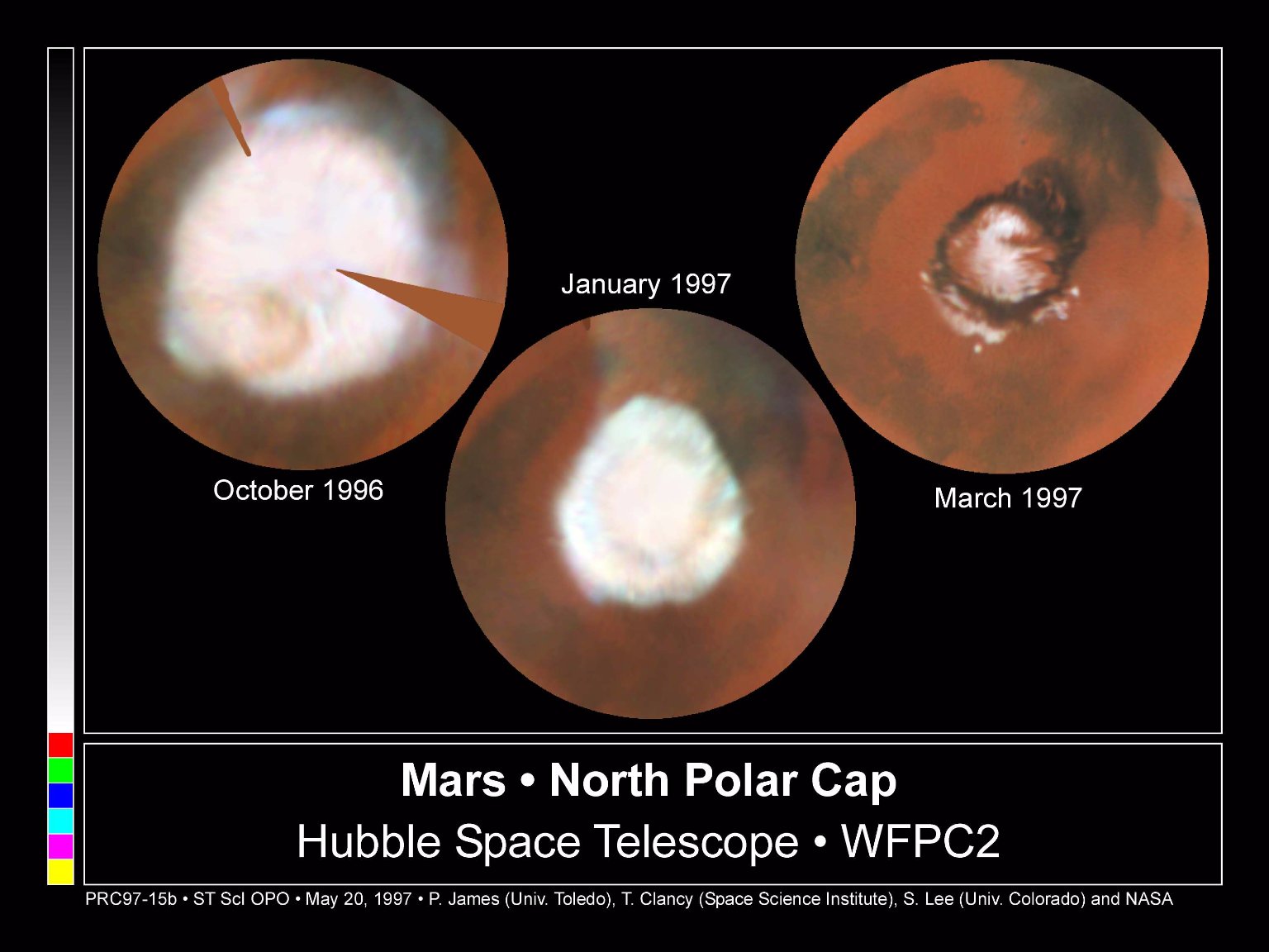
The ice caps are
composed of water ice overlain at times by "dry ice" (carbon
dioxide ice)
–Northern cap is much larger than the
southern cap
–Both caps are dissected by spiral
troughs
Not well understood what causes the
spiral pattern
Thought to be some kind of interplay
between sun and sublimation of ice
Troughs are composed of layers
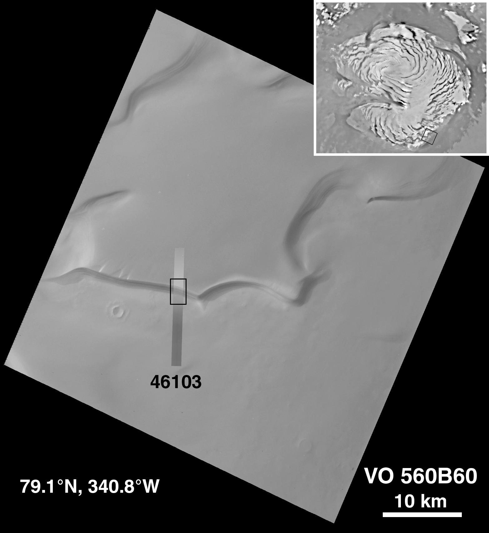
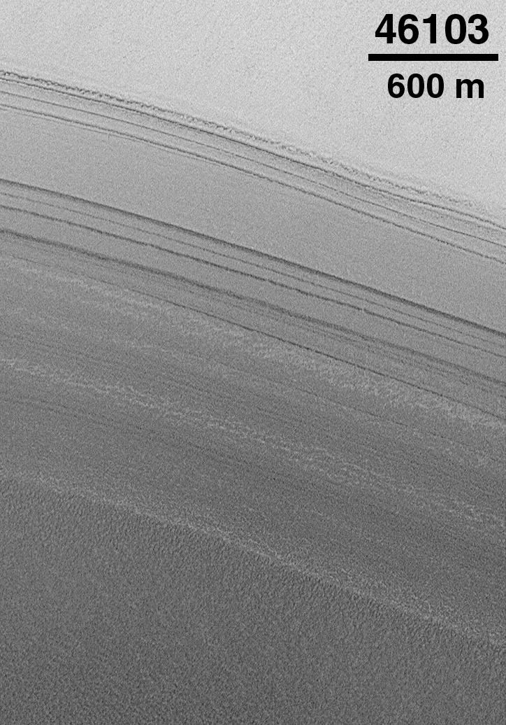
Each cap has a permanent and seasonal component
–Permanent cap is water ice
–Seasonal cap is frozen carbon
dioxide ("dry ice")
There is a great deal of
ice off the cap, especially in the Northern Lowlands
–detected by Mars Odyssey
This ice is frozen
throughout the martian year leading to a condition in the soil
known as permafrost
–Leads to the formation of Ice Wedge
Polygons:
Contracting ice cracks
Cracks infill with more water (or
dust)
Crack location from the previous year
is a weak spot and re-cracks the next year
The process repeats
Here is a view of the polygonal
terrain from orbit:
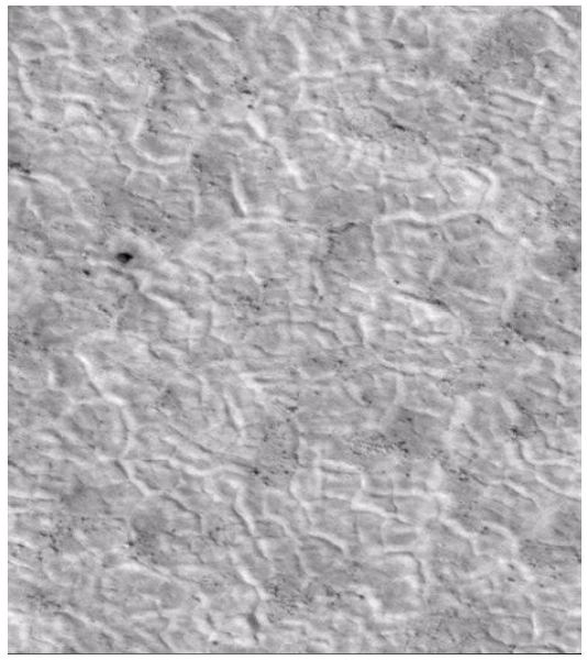
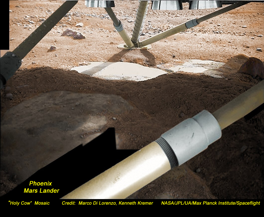
And here is a closeup view from the
UA Phoenix Lander, which is situated in the martian arctic in
just such an ice-polygon region:
An image of the underside of the
Phoenix lander, where the landing thrusters have blown aside a
thin surface layer of dust to reveal solid ice.
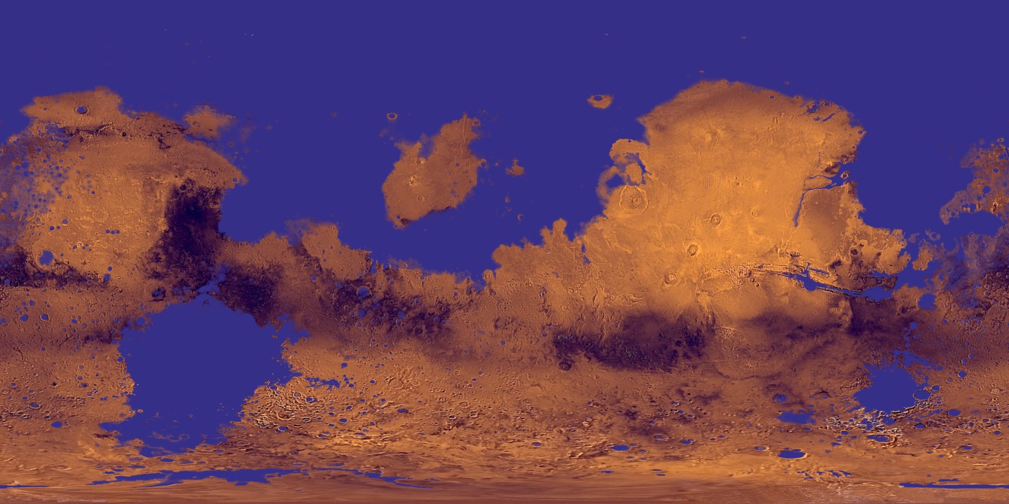
Mars is both Earthlike and Moonlike
Like the Moon, Mars is divided into old, heavily cratered
highlands and younger, lightly cratered lowlands
Mars' surface is divided into two provinces:
ancient, heavily-cratered highlands
(similar to the Moon's) located mainly in the southern hemisphere
younger plains located mainly
in the northern hemisphere.
Close to the equator of Mars we find the Valles Marineris, the
largest canyon in the solar system.
As elsewhere in the
solar system, the number of craters on a surface can be used to
date that surface
–The larger the number of craters the
older the surface
–Based on crater counts the history
of Mars can be broken up into three broad epochs
Noachian (3.5 to 3.8Gyr before
present)
Hesperian (1.8 to 3.5Gyr before
present)
Amazonian (present to 1.8Gyr before
present)
There is no evidence of major
geologic activity going on at present.
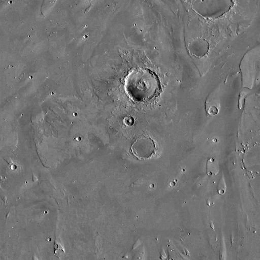
Volcanoes
There are many (extinct?) volcanoes
(nothing like them on the Moon).
Largest is Olympus Mons
– the largest volcano in the solar system
–Caldera rim stands 27km tall (88,585
feet)
–550km wide with side cliffs up to
6km in height (comparable in size to the state of Arizona)
–Caldera is composed of several
craters and is 3km deep
–The youngest volcano on Mars
Some flows have been dated to as
recently as 5Myr before present
Two other main complexes
of Volcanoes
–Elysium Mons
–The tharsis volcanoes, principally
the linear chain of Ascraeus, Arsia and Pavonis Mons
Olympus Mons and Valles
Marineris (the largest and deepest canyon system) suggest
significant activity in the past
–Together these suggest a thick
lithosphere, possibly one which thickens with time
–No Earth-style
plate tectonics (continental drift)
We believe that Mars has a thick
lithosphere, somewhat like the smaller planets Mercury and
Moon.
The evidence for the thick
lithosphere is the enormous shield volcanoes.
They build up to great heights because the thick lithosphere
can't move much over "hot spots".
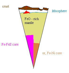
Here is our best guess about Mars' interior structure:
Here is a view of the summit of
Olympus Mons, the largest shield volcano on Mars (and, in
fact, the largest volcano in the solar system).

Notice the "wrinkle ridges" inside
the caldera, and the lava flow tubes on the slopes
(analogous to lunar rilles).
We will discuss the difference
between an impact crater and a caldera.
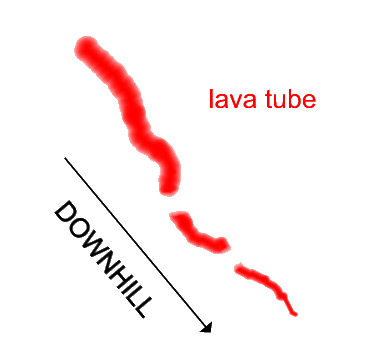
It is important to note that
lava flow channels always get narrower downstream,
because the lava cools and solidifies, becoming part of the
channel walls.
Lava tubes get narrower
downstream, like this:
In contrast, water flow channels
always get wider downstream, and have a dendritic
(branch-like) structure:

Mars continued
More on how
to tell a water flow feature from a lava flow feature:
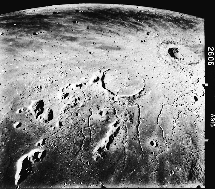
Apollo
15 metric camera picture of sinuous rilles (at bottom of
image) east of the Moon's Aristarchus Plateau. The rilles have
the appearance of lava channels or collapsed lava tubes, and
most originate on craters. The largest rille in this
southward-looking oblique view is Rima Prinz, which starts at
the center of the image at the crater Prinz (25.5 N, 44.1 W;
46 km in diameter) and trends generally northward (down).
Oceanus Procellarum is at upper left and the bright 40 km
diameter Aristarchus crater is at upper right, at 24 N, 47 W.
(Apollo 15, AS15-2606)
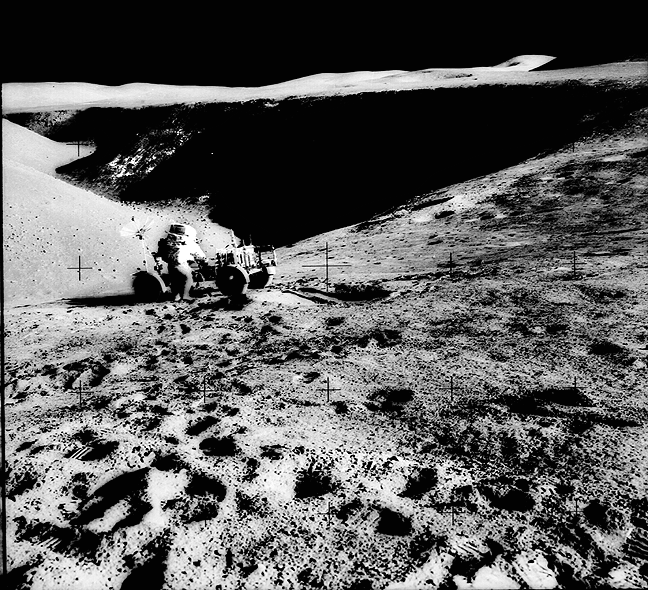
 And, here's
a close-up look at a lunar rille (lava tube):
Apollo 15
astronaut James Irwin and the rover at the edge of Hadley Rille
on the Moon. David Scott took this Hasselblad picture looking
northwestward from the flank of St. George crater. The rille has
been widened and made shallower over time by wasting from the
walls. Talus blocks are visible on the walls and on the floor of
the rille. (Apollo 15, AS15-85-11451)
And, here's
a close-up look at a lunar rille (lava tube):
Apollo 15
astronaut James Irwin and the rover at the edge of Hadley Rille
on the Moon. David Scott took this Hasselblad picture looking
northwestward from the flank of St. George crater. The rille has
been widened and made shallower over time by wasting from the
walls. Talus blocks are visible on the walls and on the floor of
the rille. (Apollo 15, AS15-85-11451)
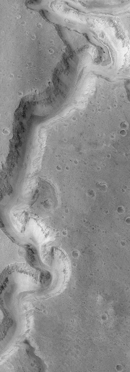
Water
on
Mars in the past
The story of
past flowing water on the surface
Morphological:
–Dry riverbeds seen by Mariner
–Streamlined crater “islands” and
outflow channels
–Possible Coastline dividing
highlands and lowlands
–River deltas seen by Mars Global
Surveyor
–Fossilized water dunes at
Opportunity’s Landing Site
–Gullies in Craters as seen by Mars
Global Surveyor
Mineralogical:
–Jarosite found at MER
Opportunity’s Landing Site requires liquid water for formation
Chemical:
–Polar caps on their own are
significant as possible remnants of a limited hydrosphere
–Viking Isotopic analysis suggests
more water in the past
In addition to
Phoenix, there have been a number of successful Mars surface
experiments. We have the two Mars
Exploration rovers, "Spirit" and
"Opportunity". Spirit is now dead, but Opportunity is
still working. Both landers worked well into their
extended missions, exploring opposite sides of Mars in regions
that are now known to have been once inundated in liquid water.
The newest
Mars Rover is the much larger Mars Science Laboratory Curiosity,
which is examining evidence for ancient water flows in Gale
Crater:
Landing
site link
Was there an
ocean in the North?
–Viking and Mariner observed a
marked difference between the hemispheres with fewer craters in
the North than in the South
–The MOLA Altimeter on the Mars
Global Surveyor determined that the North consists of lowlands
and South consists of highlands
A
"fanciful" map of Wet Early Mars (William R. Johnston):
 However,
there is relatively little evidence of shoreline features like
those we see on Earth. Thus basins may have been only
periodically flooded
However,
there is relatively little evidence of shoreline features like
those we see on Earth. Thus basins may have been only
periodically flooded
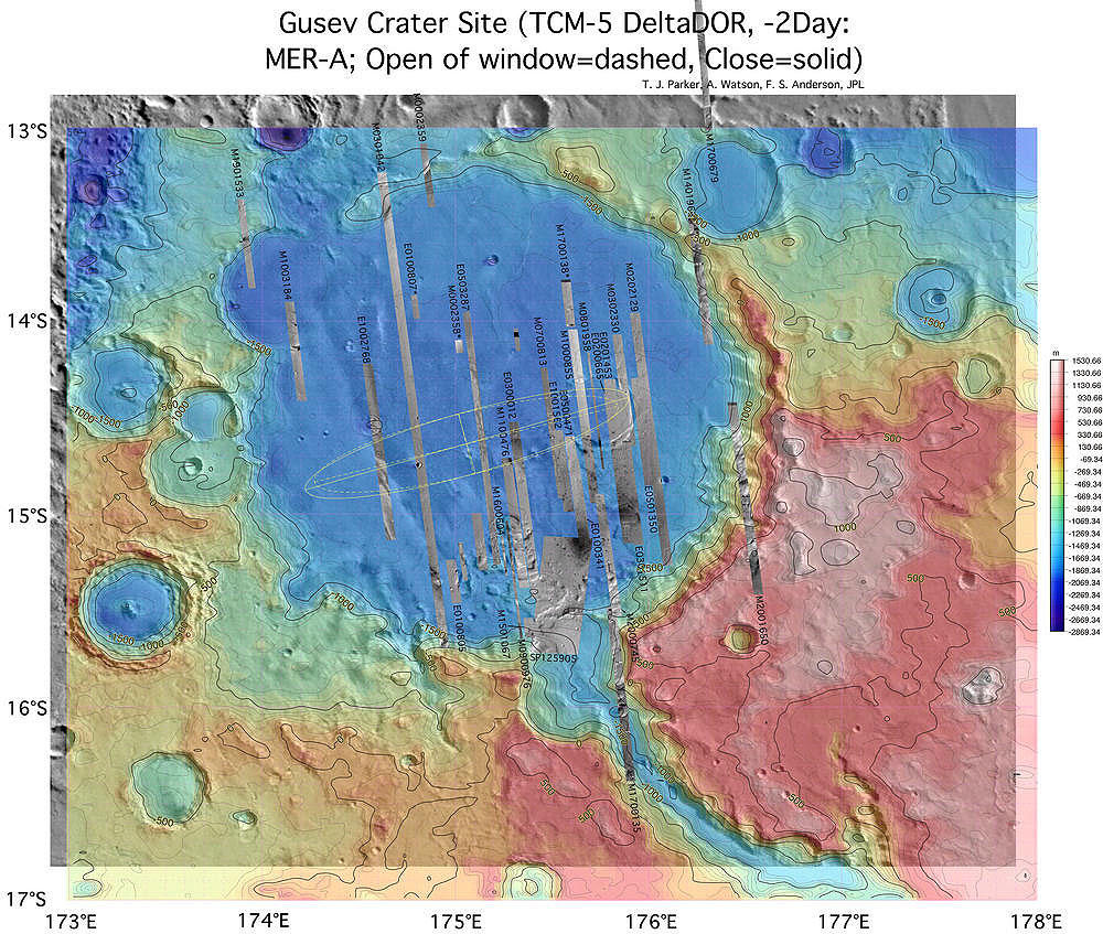
MER Spirit landing site:
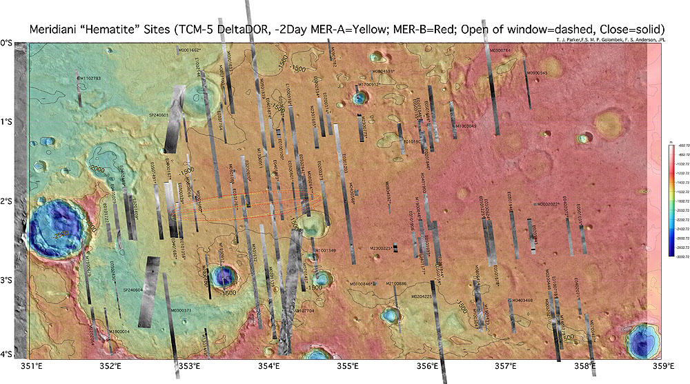
Opportunity landing
site:
Hematite
is a mineral that may be associated with liquid water.
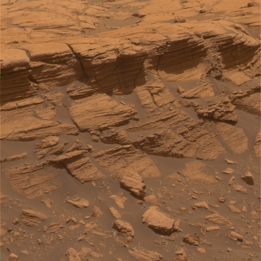
View of layered terrain near Opportunity landing site:
 Opportunity
has finished exploring Victoria crater (download
movie) and is moving on to another site.
The key
question: how long ago did Mars have liquid water?
Did it have liquid water more than once?
In the
northern hemisphere are found dendritic flow channels
(especially in the Chryse region).
And here is
an image of dendritic flow channels:
Opportunity
has finished exploring Victoria crater (download
movie) and is moving on to another site.
The key
question: how long ago did Mars have liquid water?
Did it have liquid water more than once?
In the
northern hemisphere are found dendritic flow channels
(especially in the Chryse region).
And here is
an image of dendritic flow channels:
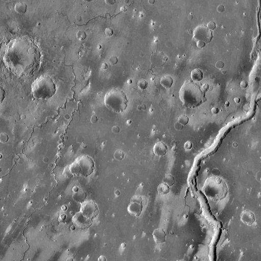 The image
shows numerous channels carved by liquid. It also shows
windblown dust patterns. Notice how wind has scoured dust
from crater bottoms and blown it out toward the southwest.
The image
shows numerous channels carved by liquid. It also shows
windblown dust patterns. Notice how wind has scoured dust
from crater bottoms and blown it out toward the southwest.
It is important to note that liquid water cannot exist on the
present-day Martian surface. The temperatures are too low and
the atmospheric pressure is too low. We will discuss this
in more detail later.
Nevertheless, water is the only substance likely to have
produced the liquid erosion. Now here is more evidence for water
on Mars:
This is a high-resolution view
of a "river bed" on Mars from Mars Global Surveyor. The
image is only a few km across. It looks like a feature
produced by a long-term stream, rather than by terrestrial
flooding.
There is also evidence for
subsurface frozen water, like tundra. Here is an image of
the crater Yuty, a so-called pedestal crater with lobate
ejecta. Also notice the flow patterns to its right:
Here is very dramatic evidence for water from Mars Global
Surveyor. This shows a crater which was buried under
deposits, and then unburied by floods:
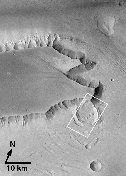
The area in the box (only
about 10 km across), enlarged:
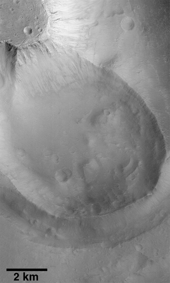
Evidence for subsurface water from
Mars Global Surveyor?
gullies in a crater wall
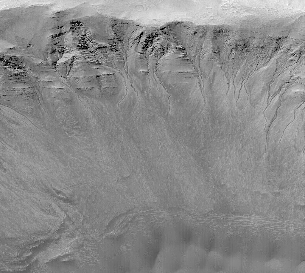
Some planetary scientists think these may be sand flows rather
than water flows.