HiRISE Stereo
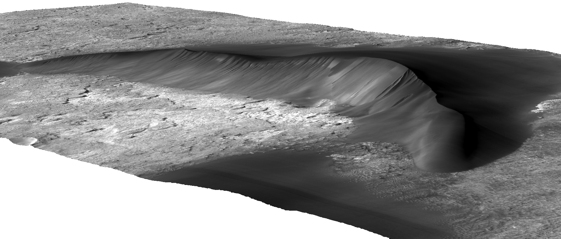 |
The perspective view to the left was created from HiRISE stereo imagery. The large barchan dune shown here is part of the Kaiser crater dunefield at 20E, 47S. The dune is ~290m high and 7km across. Over 1600 stereo pairs have been acquired by HiRISE. The DEM and orthoimages shown to the left were produced by the USGS. |
|
Stereo overlaps through WFS and WMS
I store the features representing stereo overlap areas in a Postgres database. I also run a geoserver that connects to this database. The geoserver allows you to see these data via WFS and WMS.
The geoserver runs at: http://whopper.lpl.arizona.edu:8080/geoserver/
You can configure your GIS client software to point to this server and retrieve the necessary features. The exact method to do this depends on what GIS software you use e.g. ArcGIS, uDIG, SAGA etc...
Shapefiles of stereo overlaps
Stereo overlap areas were computed by intersecting the footprints of the two component images. Several quantities of interest (e.g. stereo convergence angle, overlap area etc...) were calculated and included in the attribute table. Last Modified Thursday, 20-Feb-2014 09:23:51 MST.
- Download compressed shapefile with ographic latitudes
- Download compressed shapefile with ocentric latitudes
Alternatively, you can pull a shapefile with these data from the Geoserver that I have running with a command like...
|
wget -O temp.zip "http://whopper.lpl.arizona.edu:8080/geoserver/wfs?version=1.0.0&request=GetFeature&outputFormat=shape-zip&typename=Mars:hirise_stereo_ographic&bbox=-180.0,-90.00,180.0,90.0" |
Stereo pairs by theme
A somewhat older piece of code generates a bunch of webpages for each of our science themes. The pages show the status of the suggested, planned and acquired images in each theme. A stereo pair appears under a theme if that theme is listed as either the primary or secondary science theme on any of the component images.
Clickable location map of stereo overlaps
You can browse the same data in map form here. Clicking on a footprint will bring up the attribute data including the image IDs. The features are the intersection of the footprints of the two component images of the pair. Global and two polar maps are available.
Choose the map you want: