Helicopter Reconnaissance - Part One
How and Why?
Erin’s and my primary goal for the day was to determine our science and camp locations, which involved a helicopter flight out to the site and which also provided an opportunity to drop off our first load of gear. Yesterday, when we met with the Air Greenland fellow to confirm the details of our plan, the forecast indicated there was little chance that we would be able to fly as planned due to fog. Thankfully, the forecast was wrong.
We need the science site to be located over the center of the subglacial lake, as estimated from examining the subtleties of satellite imagery, and in a place that would be minimally affected by surface melt between now and instrument removal in August. We hoped that the surface conditions there at the center of the hidden lake would allow us to camp in close proximity to reduce time spent travelling between camp and work site every day. More broadly, we needed to confirm our suspicion that there were not any crevasses in the area so that we don’t have to spend time managing the risk of someone falling into one!
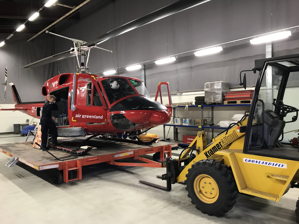
We woke up to enough sunshine coming through the patchy fog to give us hope that we would actually fly. After breakfast and gathering a few last minute items from the warehouse, we all headed over to the helicopter hanger to help the air crew load our cargo. We were happy to find that what had appeared to be too much cargo to fit into the helicopter, even to the eyes of the Air Greenland staff, indeed fit nicely inside with enough room left over for Erin and me to ride comfortably.
The helicopter, a Bell 212 very similar to the ones that Erin and I have flown in many times in the Antarctic, was positioned on a flatbed trailer that was hauled out of the hanger and onto the flight pad… with Erin and I riding along sitting on our seats inside the helicopter, door open, and waving as if we were on a float in a parade; a comical moment.
The flight was approximately 45 minutes north to the village of Qaanaaq where we landed at Air Greenland’s facility to refuel. As you can imagine, it was a beautiful flight over frozen fjords lined with cliffs of various angles and colors of rock, with an array of sea ice features spread out below. We admired many shapes and sizes of icebergs locked into the frozen ocean, and saw a few areas of open water dotted with various bits of sea ice and bergs bobbing along in the with wind. On the sea ice we could see tracks from dogs pulling the sleds that the local people use in addition to snowmobiles. We also flew over the broad flat glacier covering the peninsula that, in places, fell off in chunks onto the sea ice. The exposed land, which was mostly the south facing slopes, appeared devoid of vegetation though I suspect that this is not at all the case; it is still early spring here. I am eager to see the changes that will have occurred by the time we return in August.