By Daniel Stolte, University Communications - November 29, 2018
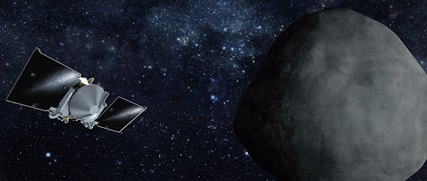
Since it launched on Sept. 8, 2016, the spacecraft of the University of Arizona-led OSIRIS-REx asteroid sample return mission has been catching up with its destination, asteroid Bennu, on its trip around the sun. On Dec. 3, the spacecraft is scheduled for arrival. UANews asked mission experts about what lies ahead for the robotic explorer and its human companions here on Earth.
Once OSIRIS-REx arrives at Bennu, why will have to stay in orbit for two years before going for the sampling?
Dante Lauretta, OSIRIS-REx Principal Investigator: The OSIRIS-REx spacecraft will enter orbit around Bennu by moving at a very slow velocity, relative to the asteroid, on the order of 4 inches (10 centimeters) per second. To accomplish this feat, we must characterize the mass, shape and rotation state of the asteroid. Fortunately, the equations for orbital stability hold even for a very low mass object like Bennu. The challenge lies in the fact that other forces acting on the spacecraft, such as solar radiation pressure, spacecraft outgassing and thermal radiation, are of the same order of magnitude as Bennu’s gravity. The team must perform regular optical navigation-based orbit determination. This process is not required to keep us in orbit. Instead, it is needed for us to understand where in the orbit we are. Although small, these forces can move the spacecraft by as much as 180 degrees along its track within a few short days. If we lost track of the spacecraft position in orbit, we would not know where to point the science instruments to collect our data.
Christian Drouet d'Aubigny, OSIRIS-REx Camera Suite Deputy Instrument Scientist: We need to know exactly where we are with respect to Bennu. To an astronaut, it would be obvious: "The asteroid is over there and all I have to do is point the camera." But with a robot, it's always a challenge. The spacecraft knows exactly where it is with respect to stars, because it knows the constellations it sees with great precision, but it doesn't know exactly where it is with respect to Bennu. When we plan our operations, weeks ahead of time, we have to take into account that when we execute the observation, the spacecraft position with respect to Bennu won’t be known exactly. The spacecraft’s own knowledge of where it is located is based on observations that are at least a day old. It knows where it should be based on where it was yesterday.
Bashar Rizk, OSIRIS-REx Camera Suite Instrument Scientist: We don't have all the information we need to successfully and safely take a sample from the asteroid at this time. We have given ourselves enough time and margin to gather all the information we need to be able to analyze and chew on that information so it can successfully inform the next step in the process.
How does the spacecraft stay in orbit around Bennu?
Rizk: Driving a spacecraft around an object like Bennu is a fine art, and we're learning it as we go along. Unlike a spacecraft that orbits a planet such as Mars, the relative velocities are not high – we are crawling along – but because the gravitational forces are so weak, other effects begin to matter. Our spacecraft is constantly exposed to solar pressure and thermal asymmetry: whichever side happens to be facing the sun gets warmer and emits its own thermal radiation. That radiation carries momentum – a very slight momentum, but given enough time, it is going to make itself felt. In addition, you have the effects of the micro-thrusting maneuvers that help us move around. So far, every aspect about this object has been very successfully predicted, so we have high hopes, but there is no denying that there are challenges.
What "eyes" does the spacecraft use to see and study the asteroid?
d'Aubigny: The spacecraft has three science cameras – all were built here at the University of Arizona – PolyCam, MapCam and SamCam, plus a suite of wide-angle cameras made by Malin Space Science Systems for Lockheed Martin that are used for navigation. When the asteroid still was far away, we used PolyCam to acquire the first images from 1.2 million miles (2 million kilometers) away because it is the most sensitive of all the OSIRIS-REx cameras. On Nov. 15, when the spacecraft was only 75 miles (120 km) from Bennu, we switched to MapCam. We are progressively switching from higher magnification and narrower field of view to lower magnification and a wider field of view. It's similar to what you would do with an optical zoom lens, but done with different cameras. MapCam and PolyCam will be used to study the asteroid from up close. MapCam is going to map Bennu's surface. As we go past the asteroid and see different parts, we will point the spacecraft in various directions, take mosaic images and stitch them together. We'll go through different phases, getting progressively closer to Bennu, starting from 12.4 miles (20 km) and getting into orbit as close as .9 mile (1.5 km) from the asteroid. The closest approach will be is when we do our reconnaissance passes at 656 feet (200 meters) above the surface. The images with the highest resolution will be taken by PolyCam, which will serve as our high-power telephoto lens. At closest approach, the field of view comes down to a 10-foot-by-10-foot (3 m) square, or approximately the size of a bedroom, and with enough resolving power we could see a pea on a table. Using MapCam, which has not quite the high resolution and magnification of PolyCam, we're going to map the whole surface down to a scale of one-quarter of a meter (.82 feet), about the size of a soccer ball.
How will you prepare for the sampling?
d'Aubigny: Based on the images and combined information from all the instruments, such as LIDAR and the spectrometers, we will narrow down the search for sites that are interesting from a science standpoint, have the surface with material of the size we need for sampling and are free of hazards. We have to focus on up to five sites, we will image those with really high resolution with PolyCam from orbit, but also as we narrow down that list, at some point we will have just two – a primary and a secondary samples site – and that is where we will do the close reconnaissance passes.
Dani DellaGiustina, Lead Image Processing Scientist: The first thing we need to do before we can start mapping the surface and finding anything that could pose a hazard to the sampling mechanism is to relate the images taken by our cameras to the shape model of the asteroid. To do this, we take the images and map them into something that is similar to Google Earth, a special framework on which we can co-locate the features. We take two approaches to mapping out hazards: one is old-fashioned counting. Keara Burke, a UA undergraduate student who has taken the initiative to develop software for this project, is leading that work. Her team will count boulders on Bennu's surface. The other is using a crowdsourcing effort: we want to triage the areas that look really smooth and map them out. For this, we are partnering with CosmoQuest, a citizen science program. Early next year, we're going to launch "Bennu Mappers," which will enable citizen scientists to help OSIRIS-REx map the locations and the sizes of all the boulders on Bennu. We define any boulder that is bigger than 8.3 inches (21 cm) as a hazard, because that is the width of the inner chamber of our sampling mechanism and it could become clogged. When we've gotten to the point where we've mapped the surface to where we have narrowed down two potential sampling sites, we will look at cobbles and pebbles while searching for anything as small as .8 inch (2 cm). Particles that size or smaller are easily ingested by our sampling mechanism.