LPL Fieldtrip (PTYS 594A)
by Christopher Hamilton
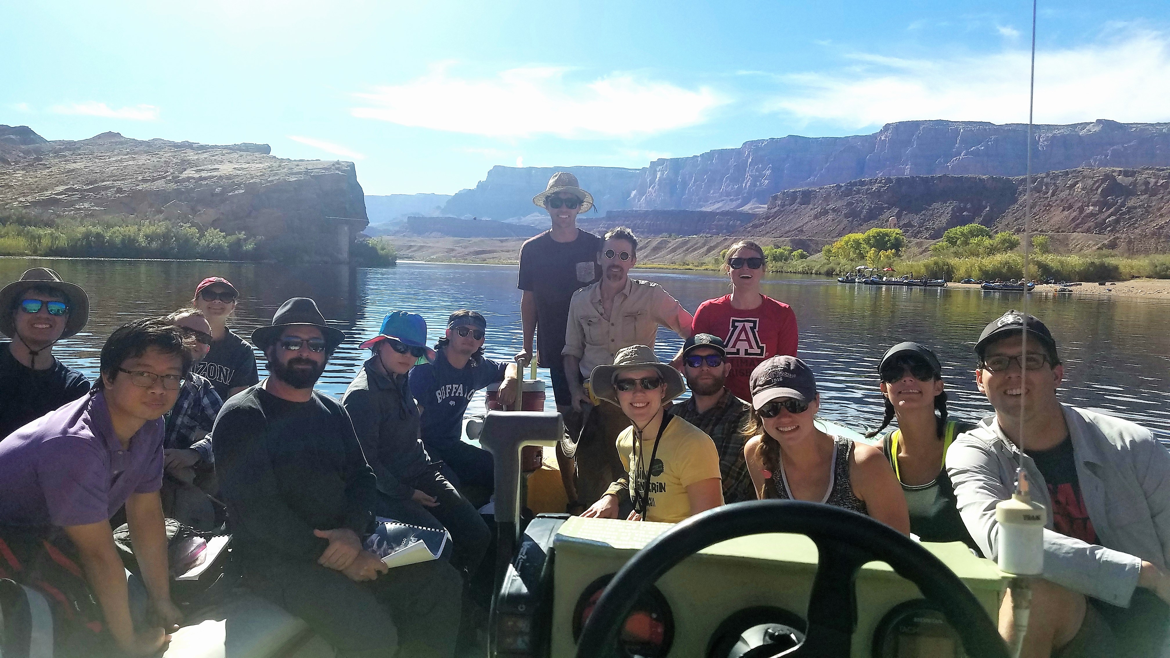
Field trip participants: Ali Bramson, Laci Brock, Saverio Cambioni, Indujaa Ganesh, Anthony Garnello, Christopher Hamilton (Instructor), Tad Komacek, Daniel Lo, Patrick O'Brien, Sarah Peacock, Kyle Pearson, Laura Seifert, Joe Spitale (co-instructor), Maria Steinrueck, and Adam Sutherland.
During the Late Jurassic (~190 million years ago), what is now Arizona was a part of Pangaea, just as it was beginning to rift apart. At the time, northern Arizona was located near the equator at about 10°N. However, the region was far from being lush. Located in the "rain shadow" of the Central Pangaean Mountains, the region was part of vast "sand sea," called an erg. The erg covered 625,000 square kilometers and was characterized by enormous dunes, similar to those now found within the much smaller Namib Sand Sea, Sahara and Gobi Deserts. Dominantly formed through processes of wind-borne (aeolian) sediment transport, the sand sea developed into a nearly 700 m-thick red cross-bedded sandstone deposit, called the Navajo Sandstone Formation.
For fall 2017, LPL field trip students traveled to the Page region of northern Arizona to obtain a closer look at the Navajo Sandstone Formation, to learn more about their origin, and to discover how they have been modified since the break-up on Pangaea. On October 6, the LPL group drove to Page, via Flagstaff, stopping at the Sunset Crater National Monument and hiking to the top of Lenox Crater to view the San Francisco Peaks. The region includes over 600 volcanoes emplaced over the past 6 million years; the youngest of these volcanoes, Sunset Crater, formed less than 1000 years ago. From there, the group continued on to Page and the field trip focused mainly on exploring the Navajo Sandstone Formation within two cross-sections provided by the Colorado River Gorge and the Water Holes Canyon.
The next day, the LPL group had an opportunity to travel from the Glen Canyon Dam to Lees Ferry by taking a river raft along the Colorado River. From the water, the towering walls of the gorge rose up over 300 m, provided an exceptional view into the stratigraphy as well as tectonic history of the Navajo Sandstone Formation. The rafting trip also enabled students to stop along the way to see Native American petroglyphs carved thousands of years ago into dark "desert varnish" on the rocks. On the drive back to Page, the group stopped at the Horseshoe Bend overlook to present their research on the geologic history of the region and the processes that lead to the formation of the Navajo Sandstone Formation and more recent Colorado River.
With this perspective, students were able to spend the following day exploring the Water Holes Canyon, which serves as an ephemeral tributary to the Colorado River. Much like the famous Antelope Canyon, the Water Holes Canyon trail winds its way through impressive slot canyons carved into the Navajo Sandstone Formation. In this setting, students shared their presentations related to the geological and ecological characteristics of the region as well as eolian and aqueous processes. The group also developed their observational skills by making geological sketches in their field books and measuring the orientations of bedding planes, unconformities, and faults. On the way back to Tucson, late in the afternoon on October 9, the group stopped outside Cameron to see the remains of a reclaimed uranium mine and discuss aspects of economic geology and its effects on the region.
This focused field trip provided a deeper look at the Navajo Sandstone Formation and its place within the "Grand Staircase," which is an exceptional stratigraphic succession exposed through the southwest United States. Additionally, students drew connections to other Earth-like and exotic planetary bodies like Mars and Titan, connecting the processes they observed to those operating on other worlds.
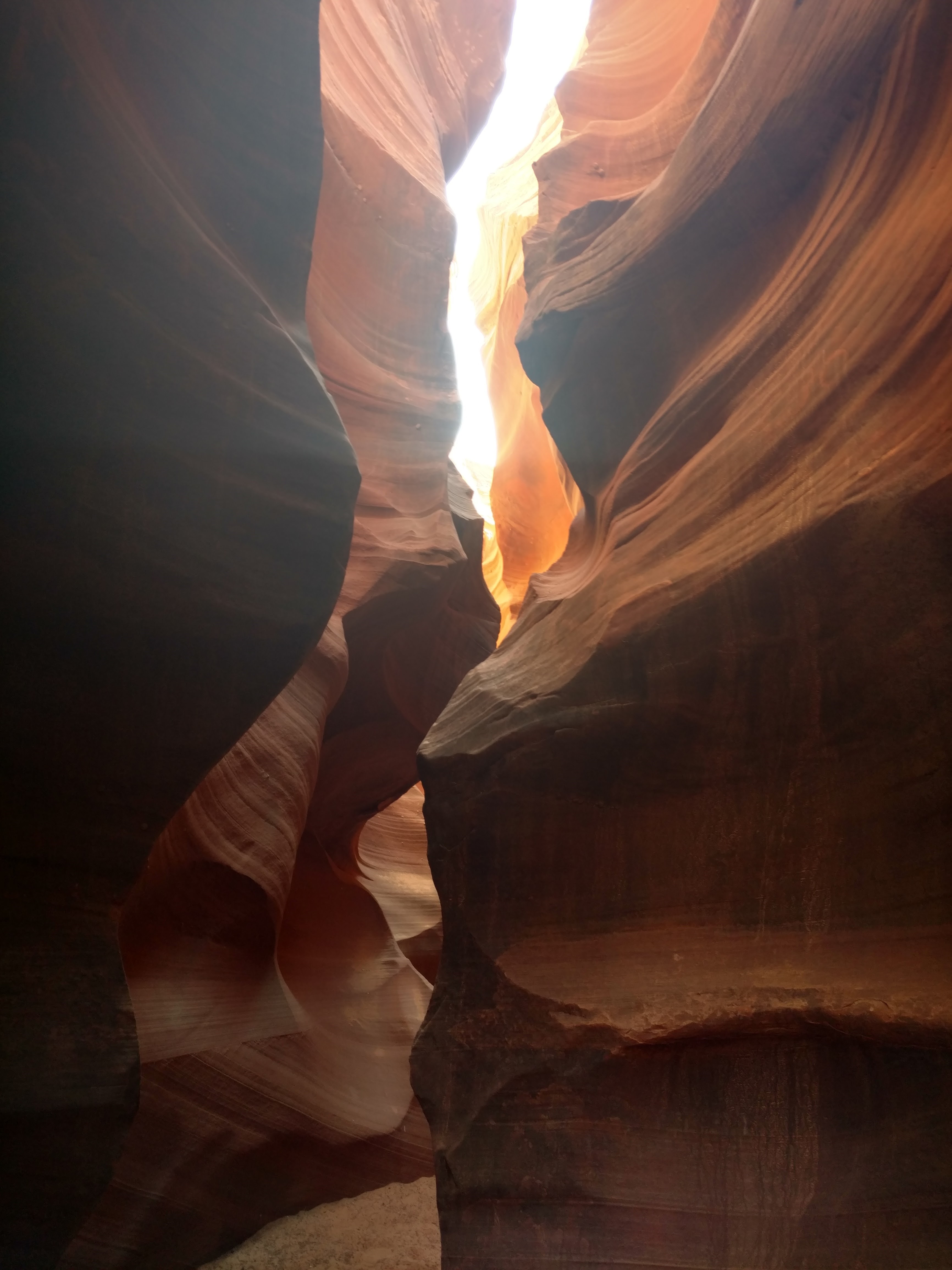
Water Holes Canyon trail providing exposures through Navajo Sandstone Formation (photo: Adam Sutherland)